Yellow, orange, red: what a wind warning for Langley actually means now
Environment Canada rewrote its alert system a year ago. A wind warning now comes with a colour, an impact level and a confidence level, and the old 'gusts to 90' line is only part of the story. Here's how to read one, with Saturday night's warning for Langley as the worked example, and what's worth doing before the wind arrives.
Saturday morning, Nov 7, Environment Canada put out a wind warning for Langley: southeasterly winds of 70 km/h gusting to 90 from early evening, easing Sunday morning. If you looked closely at the banner, it was yellow, and the text said “Impact level: Moderate” and “Forecast confidence: High”. Those three details are new, and they’re the useful part. Some questions we’ve had, answered.
Didn’t a wind warning used to be a fixed number?
It did. For years a wind warning was triggered by published speed thresholds, and the numbers did the talking. In November 2025 Environment Canada retired those criteria and replaced them with what it calls Impact Guides. The speeds still appear in the warning text, but the decision to warn, and what colour the warning gets, now rests on two judgments: how bad the effects are likely to be where you live, and how sure the forecasters are that it will happen.
What do the colours mean?
Every warning, watch and advisory now carries one of three colours.
- Yellow: hazardous weather that may cause damage, disruption or health impacts. Effects are moderate, local or short-lived. Yellow is the common one; most of the wind warnings Langley gets each winter will be yellow.
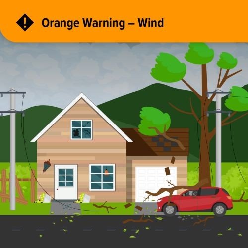
- Orange: severe weather likely to cause significant damage or disruption, widespread and possibly lasting a few days. Environment Canada says orange is uncommon.
- Red: very dangerous, possibly life-threatening weather with extreme, widespread and prolonged effects. Rare.
For wind specifically, the agency’s own examples are: yellow means some short outages, larger branches down and a risk of flying debris; orange means widespread outages, some roof damage, small to medium trees snapped and high-sided vehicles pushed around; red means long, widespread outages, structural damage to homes and significant damage to tree stands and parks.
How do they pick the colour?
With a grid. Forecasters rate the likely impact as moderate, high or extreme, and their confidence as low, moderate, high or very high, and the square where those meet gives the colour. A few examples from the agency’s own threshold list:
- Moderate impact plus high or very high confidence is yellow. That was Saturday’s warning.
- High impact plus high or very high confidence is orange.
- Extreme impact plus very high confidence is red.
- A high-impact event the forecasters aren’t yet sure about starts as yellow and can be upgraded.
So an orange warning doesn’t necessarily mean stronger wind than a yellow one. It can mean the same wind arriving when the trees are in full leaf, or the ground is soaked, or it’s hitting a bigger population, so the damage is expected to be worse.
What’s the difference between a warning, a watch, an advisory and a statement?
A warning means act now: severe weather is happening or will happen, usually with 6 to 24 hours’ notice. A watch means get ready: conditions favour severe weather and the watch may become a warning as certainty grows. An advisory is for less severe but still significant weather, and is used for things like fog, frost, freezing drizzle and blowing snow. A Special Weather Statement is not an alert at all; it’s information about weather that’s unusual or inconvenient, and it has no colour. If Langley is under a statement rather than a warning, the forecasters are telling you to pay attention, not to act.
Air quality is handled separately now too: the old Special Air Quality Statements are gone, replaced by Air Quality Warnings when smoke or similar is expected.
Which forecast region is Langley in?
“Metro Vancouver - southeast including Surrey and Langley”. Both the City and the Township fall under it. When a warning lists regions, that’s the line to look for. The region next door, “Fraser Valley - west including Abbotsford”, was also named on Saturday, so the east end of the Township was covered either way.
What should we actually do before a yellow wind warning?
The Township’s own storm page and Saturday’s warning text agree on the short list:
- Secure loose things. The Township’s list is garbage cans, barbecues and lawn furniture; add planters, trampolines and anything else in the yard that catches wind. The warning for Saturday specifically said “secure loose objects” and noted that fences and “soft shelters” (gazebos, car canopies, pop-up tents) are the usual casualties.
- Look up at your trees. Dead branches over the driveway or the roof are the ones that come down. The Township asks residents to prune dead wood on their own property, and to report a damaged tree on Township land through its online form. Our trees on your property page covers what you can and can’t cut without a permit.
- Clear the catch basin out front. Wind warnings in Langley almost always arrive with rain. If the storm drain at the curb is under leaves, the puddle in front of your house is on you.
- Charge things and find the flashlight. Yellow wind warnings are the ones that produce “some short-term outages”. Our power outage explainer has the BC Hydro numbers and what to do while you wait.
- Rethink the drive. The Township’s advice is to avoid unnecessary travel and watch for branches on the road. If you have to drive and it gets bad, pull off away from trees and power lines, stay in the car and put the hazards on.
During the storm, two numbers: a downed or sagging power line is 911, and stay back 10 metres, about a city-bus length, because the ground around a live line is energized. A tree across a Township road or a blocked drain is 604-532-7300 on weekdays, 8:30 am to 4:30 pm, and 604-543-6722 after hours and weekends.
How did Friday’s warning turn out?
Friday, Nov 6 brought the season’s first storm and a wind warning for Metro Vancouver. The Langley Advance Times checked at 5 pm: heavy rain and deep puddles at midday, gusty wind, no serious damage, and the only outage on the BC Hydro map in Langley was a planned maintenance job in Walnut Grove. That is roughly what “yellow” is supposed to look like. The forecast for the week ahead is wetter still, so expect to read a few more of these.
Update, Nov 9: Saturday’s yellow warning ended with thousands in Langley and Aldergrove losing power overnight, and Environment Canada has a special weather statement out for heavy rain Tuesday to Thursday. Our story on the storm and the rain ahead has sandbag locations and who to call.
To get the alerts on your phone, Environment Canada’s WeatherCAN app pushes them for any location you save; Langley is a search away. The biggest events also come through Alert Ready, the system that interrupts your phone whether you asked it to or not.
More: Emergency preparedness in Langley · Langley emergency contacts · Road closures and detours