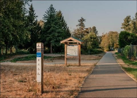
- Best all-round
- Campbell Valley's Little River Loop: about 2.2 km, packed crushed rock, mostly under 5% slope, boardwalks
- Paved
- Fort Langley National Historic Site (max 8.5% slope); Portage Park trails in Langley City
- Accessible playgrounds
- Yorkson Community Park (Willoughby), Noel Booth (Brookswood), Douglas Park (Langley City)
- Regional park hours
- 7 am to 6 pm until December 31
- Free wheelchair loan
- Fort Langley National Historic Site Visitor Centre
- Last checked
- November 15, 2026
Pushing a wheelchair, a stroller or a walker? These are the Langley trails with firm surfaces and gentle slopes, and the parks with washrooms you can actually get into. Distances and grades are as the park operators publish them, so you can judge for yourself.
Regional parks
Campbell Valley: Little River Loop
The one to start with. The loop is about 2.2 km, at least 1.7 m wide, with a firm surface of packed crushed rock. Most of it is under a 5% slope; one 40 m stretch is 6 to 8%. It crosses the Little Campbell River twice on raised boardwalks. The longer Perimeter Trail (nearly 9 km, 2.4 m wide) is mostly flat, with one short 6 to 8% pitch.
Toilets and picnic tables at the North Valley and South Valley entrances are accessible, though Metro Vancouver warns some doors and latches are heavy. Heads up: part of the park east of McLean Pond is closed this season for trail and parking-lot construction.
Brae Island: Tavistock Point Trail
A 2.1 km trail along the river in Fort Langley, firm to semi-firm fine gravel, under 5% slope, at least 2.5 m wide. The viewing platforms have one step up. The Tavistock Trail Loop adds an accessible boardwalk. Accessible washrooms are near the parking lot, there’s one accessible picnic table at the beach area and a ramp down to the beach (getting from the sand to the water is limited).
Aldergrove Regional Park: Nature Discovery Area
The loops around the Nature Discovery Area are flat and firm, close to parking, washrooms, water and benches. The Woodpecker Loop is 530 m, 2 m wide, under 5% slope. Skip the Marsh Loop (180 m of it is 9 to 11%) and the View Point Trail if steep bits are a problem. At the main day-use area the women’s washroom is accessible but the men’s has a narrow passage; both washrooms at Aldergrove Bowl are accessible. Pets aren’t allowed on the Nature Discovery Loop.
Derby Reach: Edge Trail and Edge Farm Trail
Along the Fraser at Edgewater Bar. The Edge Trail is 880 m of firm to semi-firm fine gravel, at least 1.5 m wide, with a few short slopes up to 8%. The Edge Farm Trail is 1.6 km of semi-firm gravel, flat apart from one gentle hill. Accessible toilets are at Edgewater Bar, Muench Bar and the Houston trailhead. Avoid the Houston Trail loop (slopes up to 23%) and the Fort-to-Fort Trail’s stretch between the Historic Cairn and Fort Langley, which has 14% slopes.
At Glen Valley’s Two-bit Bar, the pit toilet is accessible but the path to the river is grass.
Fort Langley National Historic Site
Paths through the fort are smooth and paved, with slopes up to 8.5%. Historic buildings above grade have ramps (some steep, some without handrails); the palisade walk is up a steep wooden staircase. There’s a manual wheelchair to borrow free at the Visitor Centre, an accessible all-gender washroom with a changing table, a wheelchair-friendly picnic table in the shelter, and noise-cancelling headphones to borrow. A support person gets in free.
Six accessible parking stalls are near the Visitor Centre, though some slope more than 8%, and pay parking applies to everyone from November 16, 2026. By bus, the nearest stop (96 Avenue at Glover Road) is a 700 m walk, partly without sidewalks. The site is open 10 am to 4:30 pm, closed December 24, 25, 26, 31 and January 1. Accessibility questions: 604-513-4777.
City of Langley
- Portage Park (204 Street and 51A Avenue) is the main entrance to the Nicomekl floodplain, with paved trails, a playground and washrooms. The Rotary Floodplain Trail heads east and west from there; the City doesn’t publish its surface, so try a short stretch first. Floodplain parking is off 53 Avenue, 203 Street and 208 Street. See Nicomekl River trails.
- Douglas Park (206 Street and Douglas Crescent) has an inclusive playground, a seasonal spray park and public washrooms, right downtown.
The City also offers a support worker pass for people 16 and over who support someone with a disability at recreation programs; call 604-514-2940.
Township playgrounds
- Yorkson Community Park in Willoughby opened the Township’s largest accessible playground in May 2026, along with an accessible spray park, new pathways, a washroom building and parking.
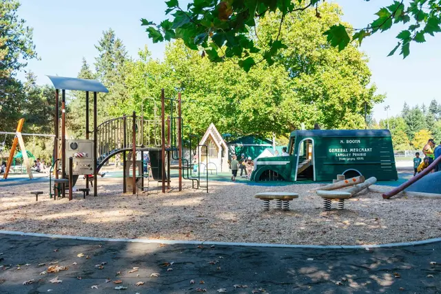
- Noel Booth Community Park in Brookswood got an inclusive playground this fall, with an accessible path linking the parking lot, playground, trails and school, transfer-friendly play equipment and sensory play.
More playgrounds: Langley playgrounds. More walks: Langley hikes and walks.
Something out of date? Tell us.
Last checked November 14, 2026. Spotted something out of date? Tell us.