- Main exchanges
- Langley Centre (Logan Ave and 203 St), Carvolth (202 St and 86 Ave), Willowbrook, Aldergrove (272 St and Fraser Hwy)
- SkyTrain
- 16 km, 8 stations, projected late 2029; two stations in Langley
- Carvolth park and ride
- 679 spaces, $2 a day or $40 a month, no overnight parking
- HandyDART
- Bookings 604-575-6600; registration 604-953-3680
- Check before you drive
- Langley road closures
Here is the honest version: in Langley, getting around means a car for most households and buses for some. A handful of bus corridors are frequent enough to live on. Rail is coming, but not until late 2029.
The bus network
Langley’s buses are TransLink buses, the same system as the rest of Metro Vancouver. There are four places where routes meet, and knowing them helps you read any timetable:
- Langley Centre, at Logan Avenue and 203 Street in the City. The main exchange.
- Carvolth Exchange, at 202 Street and 86 Avenue in the Township, with a park and ride.
- Willowbrook, the stops around the mall and Fraser Highway.
- 272 Street and Fraser Highway in Aldergrove, where the regional connection is made.
Frequency varies by time of day and direction, so use the stop-level timetable, not a route map. TransLink’s Frequent Transit Network map shows the corridors with a frequent standard. Living beside a bus stop does not mean all-day frequent service.
Routes worth knowing, checked against TransLink’s September 2026 schedules and service-change notices:
| Route | Where it goes | How often (typical) |
|---|---|---|
| 501 | Langley Centre, Willowbrook, 200 Street, Carvolth, Guildford, Surrey Central | Useful north-south spine; check your stop |
| 502 and 503 | Fraser Highway to Surrey Central; 503 is limited-stop west of Langley Centre and continues to Aldergrove | 503 about every 15 minutes weekday midday to Langley Centre; roughly alternate trips continue east |
| 555 | Carvolth to Lougheed Town Centre | About every 10 minutes weekday morning peak, 20 midday, 30 on weekends |
| 560 | Langley Centre to Murrayville | Generally hourly |
| 561 | Langley Centre to Brookswood | Generally hourly |
| 562 | Langley Centre, TWU and Glover corridor, Fort Langley, Walnut Grove, Carvolth | About every 20 minutes weekday daytime; hourly evenings and Sundays |
| 595 | Langley Centre, 208 Street, Carvolth, Golden Ears Bridge, Maple Meadows | About every 30 minutes daytime |
| 556 (new) | Langley Centre to the Gloucester industrial area via 56 Avenue | Weekday peak only, about every 30 minutes; started September 2026 |
Others, including the 509, 388, 531, 563 and 564, are peak, limited or local services; read the schedule for direction and operating hours. BC Transit’s 66 Fraser Valley Express links Carvolth with Abbotsford and Chilliwack, and the 21 links Aldergrove with Abbotsford. BC Transit uses its own fares, so confirm payment and transfers.
Fares. Buses and HandyDART are always 1-Zone. You tap on when you board a bus but do not tap off; you do tap in and out of SkyTrain. TransLink’s pricing page lists the adult 1-Zone fare at $3.50 for cash or contactless and $2.85 with Stored Value, with a single fare valid for 90 minutes and children 12 and under riding free.
HandyDART is a door-to-door shared service for people whose disability prevents them from using regular transit. Registration help is at 604-953-3680 and bookings at 604-575-6600, up to seven days ahead and until 4 pm the day before.
To tell TransLink about a missed connection or a stop that doesn’t work, use its feedback form with the route, stop, date and time. Our transit page lists more of the day-to-day details.
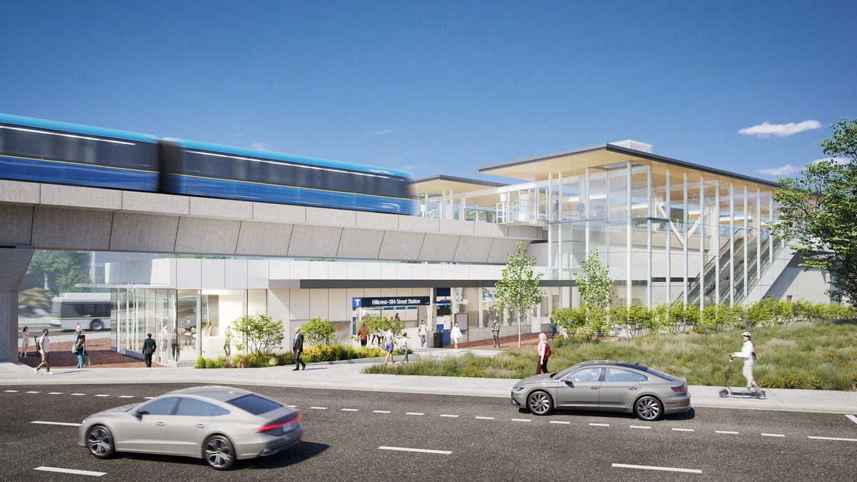
The SkyTrain: what’s real and what’s projected
| Route | Extends the Expo Line 16 km, mostly along Fraser Highway, from King George Station in Surrey to 203 Street in Langley City |
| Stations | Eight in total: Green Timbers, 152 Street, Fleetwood, Bakerview-166 Street, Hillcrest-184 Street, Clayton, Willowbrook (196 Street) and Langley City Centre (203 Street) |
| Langley stations | Willowbrook, northeast of 196 Street and Fraser Highway; Langley City Centre, east of 203 Street at Industrial Avenue |
| Status | Under construction; more than 60% of the guideway was complete in a September 2026 provincial update |
| Projected opening | Late 2029 (project site, October 2026) |
What it will change: addresses close to the Willowbrook or City Centre stations gain direct rail to Surrey and, with transfers, Vancouver. What it will not: put a station in Walnut Grove, Willoughby, Murrayville, Brookswood, Fort Langley or Aldergrove. Final feeder bus routes and frequencies for opening day have not been published. A separate plan for bus rapid transit between Langley and Haney advanced to a concept in May 2026, but we found no confirmed construction funding or opening date.
Construction is also a daily fact of life along Fraser Highway. Check the project’s current work page for lane closures, or call the project line at 1-844-815-6111.
Do not buy or rent for a train that is not running. If a listing quotes a SkyTrain walk time, the right comparison today is the bus. Treat 2029 as a possibility, and the station as a bonus when it arrives.
Driving and the congestion points
We could not find a current, comparable ranking of Langley’s slowest intersections, so we are not going to name an “always worst” one. What the official notices do show is where the construction is.
| Corridor | Where things stand (October 2026) |
|---|---|
| Highway 1, 202 to 216 Street | Widening finished in September 2020. The 216 Street interchange already exists. |
| Highway 1, 216 to 264 Street | Under construction, including added HOV and electric-vehicle capacity and interchange and bridge work. |
| Highway 1, 264 Street east | More widening under way; a July 2026 notice described temporary lane arrangements on 264 Street through November 2026. |
| 208 Street | 64 to 76 Avenue finished in July 2026; the 76 Avenue to 8100 block roadwork finished in August with landscaping to follow in the fall; the stretch toward 84 Avenue was under way. |
| Fraser Highway | SkyTrain construction continues, with lane restrictions and construction access. |
| 200 Street, Langley Bypass, Golden Ears Bridge approach | Major routes with different crossings and constraints; test your own route at your travel time. |
Official closure lists are better than a reputation: the Township’s Closures and Impacts page, the City’s roadwork page, DriveBC for Highway 1 and our own Langley road closures summary. There is also a how-to on checking closures.
How long will my commute take?
These are routing estimates from October 2026 using a central Langley start point. They are not rush-hour averages. Use them for orientation, then try your real route on a weekday.
| Destination | By car (routing estimate) | By transit (with transfers) |
|---|---|---|
| Downtown Vancouver | About 41 min, 47 km | About 1 h 40 min |
| Surrey Central | About 21 min, 22 km | About 1 h |
| Metrotown (Burnaby) | About 35 min, 37 km | About 1 h 16 min |
| Abbotsford | About 35 min, 33 km | About 1 h 56 min |
| Vancouver Airport (YVR) | About 42 min, 47 km | About 1 h 52 min |
For a decision this big, run your own comparison: the address you’d actually live at, the time you’d actually leave, the walk to the stop and the wait at the transfer. TransLink’s trip planner is the operational source.
Walking and cycling
Langley has real cycling infrastructure in places and gaps in others. The City’s Transportation 2050 plan and parks map show existing and proposed routes; the Township’s transportation strategy was in public consultation in April and May 2026, and a draft is not a built path. Many regional park trails are walking-only, so read the map before bringing a bike. Our cycling page and the hikes and walks guide list the official maps, and Nicomekl river trails covers the City’s main trail system.
Park and ride
Carvolth’s lot at 20255 86 Avenue has 679 spaces, 15 of them for carpools, at $2 a day or $40 a month, open 4 am to 2 am. Overnight storage is not allowed, and TransLink asks you to check payment rules. Our parking guide has the rules for street parking in both municipalities.
Electric vehicles
The Township’s EV page and Natural Resources Canada’s charger locator list public chargers; check connector type, hours and pricing in the operator’s app. A charger nearby does not give you permission to install one in a strata stall. See EV charging in Langley.
Planes, trains and noise at specific addresses
Langley Regional Airport (5385 216 Street) is a general-aviation airfield with fixed-wing and helicopter activity; noise enquiries go to 604-534-7330 or [email protected]. Visit any home during active flying hours. Freight trains and at-grade crossings affect parts of the Township, and whistle cessation requires a formal municipal and railway process, not a request to a driver. The Township has budgeted design work for it in 2026; that does not mean horns have stopped. See Langley Regional Airport.
Further afield
The US border crossings, airports, ferries and mountains are on getting there from Langley and US border crossings near Langley.
Related: our newcomer checklist, the home-buying guide, and the community pages for Langley City, Willowbrook and Aldergrove, where transit matters most.
Questions people ask about living in Langley
When will SkyTrain reach Langley?
Where will the Langley SkyTrain stations be?
How often does the 555 run from Carvolth?
Can I live in Langley without a car?
How long does it take to get from Langley to Vancouver?
How do I get to Abbotsford or Chilliwack from Langley by bus?
Is there parking at Carvolth Exchange?
Who can use HandyDART in Langley?
Are Langley's roads under construction?
Last checked October 29, 2026. Things change fast in a growing area: confirm anything important (catchments, rents, bus times) with the official source linked. Spotted something out of date? Tell us.