- Bus routes touching rural Langley
- 562, 503, 556, 563, and 566 (summer only). Timetable effective 7 Sep 2026, checked 30 Oct 2026
- SkyTrain
- Surrey-Langley line targeted for late 2029. Not a rural stop
- Park-and-ride
- Carvolth Exchange, 20255 86 Ave. No overnight parking
- On-street parking
- No permit programme. Ordinary vehicles up to 72 hours in one spot
- Road work now
- Highway 1 and 264 St interchange (2027 target); alternating single lane on 272 St at Nathan Slough Bridge
- Live closures
- Langley road closures and the Township closures page
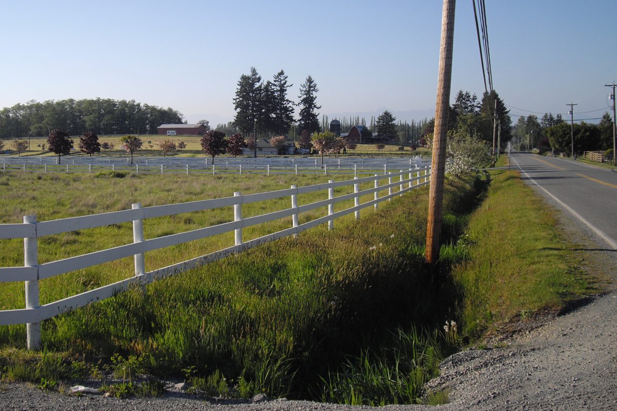
Be realistic: outside Glover Road and the Fraser Highway, a rural Langley household is a driving household. The bus network follows a few corridors, and a farm can be a kilometre from a stop with no safe way to walk to it. That is not a flaw to hide. It is the main fact to weigh. The Langley-wide getting around guide covers fares and the wider network, and our transit page lists the routes.
Which buses reach the countryside?
Frequencies below come from TransLink’s timetable effective September 7, 2026, checked October 30, 2026. They are scheduled gaps, not observed reliability, and the live lookup gives departure times for your stop.
| Route | Where it matters | Weekday peak | Weekday off-peak | Weekend |
|---|---|---|---|---|
| 562 | Glover Road and Milner, Trinity Western, Fort Langley, Walnut Grove and Carvolth | About every 20 minutes | About every 20 minutes in the daytime, then about hourly later in the evening | Saturday about every 20 minutes by day, hourly later; Sunday about hourly |
| 503 | Fraser Highway between Langley Centre and Aldergrove, on to King George and Surrey Central | Roughly 6 to 25 minutes on the Aldergrove branch, depending on period and direction | About every 30 minutes at midday | Saturday roughly 20 to 30 minutes by day; Sunday about 30 minutes. Late trips can be farther apart |
| 556 | Langley Centre, 56 Avenue, 264 Street and Gloucester | About every 30 minutes in limited morning and afternoon windows | No midday service | No service |
| 563 | Langley Centre, Brookswood and Fernridge, the western edge near 200 Street and 20 to 28 Avenues | Generally hourly, some morning trips toward Langley Centre about every 30 minutes | About hourly | About hourly, shorter Sunday span |
| 566 | Langley Centre to Campbell Valley | Not a year-round route | Summer service only | Seasonal. Confirm the operating dates |
We found no general all-day bus on the Glen Valley river roads, most southern acreage roads or the whole length of 248 and 264 Streets. A property can sit close to a route and still have no practical walk to a stop, so go and look. Live lookups: route 562 and route 503. Check service alerts before a trip.
What about SkyTrain and park-and-ride?
You can reach current rail by bus today: route 503 goes toward King George Station and Surrey Central, and the 555 from Carvolth runs to Lougheed. Carvolth Exchange (20255 86 Avenue) is an official TransLink park-and-ride, with no overnight parking, so look up its current rates and space counts first.
The Surrey-Langley SkyTrain extension has a late-2029 opening target. In its September 2026 update the Province reported about 65 per cent of the guideway built, more than 95 per cent of foundations finished and work at all eight stations. It brings rail to Langley City, not to the countryside, and no feeder bus for rural homes has been announced. We couldn’t find published distances or travel times from each hamlet to a station, and one number for all of rural Langley would hide huge differences between Milner, Glen Valley and the border roads. Time your own trip.
Driving and commuting
Rough road orientation (not a claim that any route is fastest):
- Milner and the Fort side: Glover Road and 216 Street.
- Central and eastern corridors: 232, 248 and 264 Streets.
- East-west: Fraser Highway and 16 Avenue.
- Highway 1: use the interchange that fits your address.
We have no published commute times for rural origins, so here is how to get your own. Choose the address you’re considering and a weekday arrival time, and run the trip in both directions at rush hour. Do it for the real destination (a worksite, a school, a hockey rink), not “Vancouver” in general.
Construction to know about right now (October 2026; check the live notices):
- Highway 1 and 264 Street. The interchange and mobility-hub work is under construction, with a 2027 completion target in the Province’s April 2026 update. It affects eastern routes now.
- Fraser Highway, 24300 to 24600 blocks. The Township’s four-laning, with multi-use paths and a new signalized intersection, was completed in May 2026, so expect a wider road on the Aldergrove side.
- 272 Street at Nathan Slough Bridge (8700 to 8800 block). Alternating single-lane traffic from October 14, 2026 until further notice.
- 232 Street, 72A Avenue to Rawlison Crescent. Work runs August 4 to November 30, 2026, generally Monday to Saturday, 9 am to 3 pm.
Live information: Highway 1 traffic impacts, the Township’s closures page and our Langley road closures page.
Walking and cycling
Rural walking is mostly recreation, not commuting. We couldn’t find Walk Scores or audited continuous sidewalks for the countryside, and we won’t borrow an urban number. Campbell Valley’s park map separates walking, riding and cycling routes, and bikes are allowed only on designated ones. The Township’s trail maps and GeoSource show public routes, but check the final approach and crossings yourself. See bike lanes and cycling for rides, and the directory’s rural Langley guide for the flat country-road ride from Fort Langley toward Glen Valley.
Parking in rural Langley
Rural parking is usually about lawful storage and safe access, not permit zones. The rules as the Township published them in October 2026:
- No residential parking-permit programme. The Township does not run one.
- Ordinary vehicles: up to 72 hours in the same street location.
- RVs and trailers: a total of 48 hours on the street per calendar year, and not as accommodation.
- On your own lot: a seasonal driveway exception exists for residential and specified single-family zones. Don’t assume it applies identically in a rural zone. Ask for a zoning answer for your RV, boat or trailer.
- Heavy commercial vehicles: the Township summary allows limited accessory parking in rural zones depending on lot size. That is not permission for a trucking yard, and it doesn’t override ALR rules.
- Tenants and visitors: the Township doesn’t generally require off-street tenant parking, and a curb across from your house isn’t reserved for you.
- Shoulders, ditches and mailboxes: an unpaved road edge is not automatically a legal parking bay. Check the traffic bylaw and signs, and keep sight lines and access clear.
- Schools and parks: use designated parking and follow school instructions. North Otter’s October 2026 newsletter reminded drivers not to stop in the travel lane.
More on Langley-wide rules is in the parking guide.
Rural road safety
Country roads are often narrow, ditched and unlit, and they are shared by tractors, cyclists, riders on horseback and walkers. Slow down near blind corners and horse properties, and give horses room. We found no published corridor-by-corridor collision rates, so we won’t claim one road is worse than another. For design or speeding concerns, contact Township Transportation. For enforcement, call the Langley RCMP non-emergency line at 604-532-3200. The Township’s draft Transportation and Mobility Strategy was in consultation as of July 22, 2026, and its final adoption wasn’t confirmed, so treat its proposed networks as proposals.
Back to the rural Langley overview. See also schools for the bus rules and County Line and Coghlan for the interchange area.
Questions people ask about Rural Langley
Is there a bus in rural Langley?
How often does route 556 to Gloucester run?
Can I take a bus to Campbell Valley Regional Park?
When will SkyTrain reach Langley?
Can I park an RV or trailer on a rural Langley road?
How do I report speeding or an unsafe rural road?
How long does it take to drive to Vancouver from rural Langley?
Last checked October 29, 2026. Things change fast in a growing area: confirm anything important (catchments, rents, bus times) with the official source linked. Spotted something out of date? Tell us.